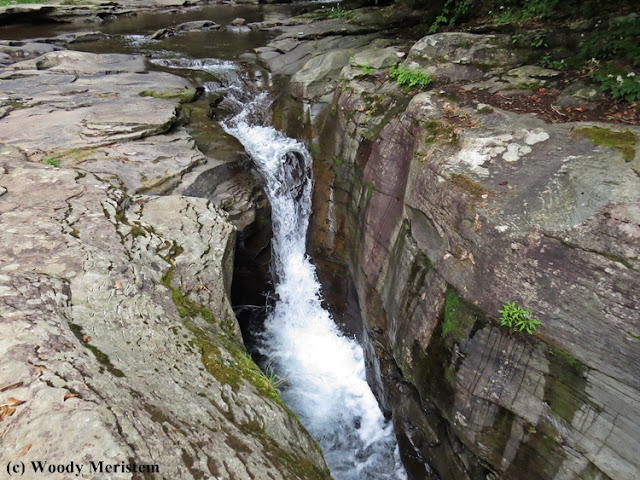
Rock Run begins in the acidic wetlands
along the border of Pennsylvania’s Lycoming and Sullivan counties, flowing in a
generally southwestern direction until it flows into Lycoming Creek near
Ralston. This is not the only Rock Run in Pennsylvania, a state whose early
explorers and settlers were particularly unimaginative when naming waterways,
but it is probably the most beautiful of those bearing the name.
The headwaters of Rock Run’s North Branch
are in the Loyalsock Sate Forest’s Devils Elbow Natural Area with its extensive
wetlands of emergent vegetation and wooded wetlands dominated by eastern
hemlock –
Leaving those wetlands Rock Run becomes a
high-gradient free-stone stream as it begins its descent from the Allegheny
Plateau, losing 1000 feet in elevation in its first five miles. After Yellow
Dog Run joins Rock Run, the stream’s gradient diminishes and the nature of its
bed changes. Now segments of gravel bottom alternate with extensive sections of
bedrock.
Some of the potholes contain smaller
rocks of the sort that, swirling around during high water events, wore away the
bedrock to create those potholes–
Rock Run’s beauty has attracted visitors
for decades. Unfortunately, about 25 years ago the valley began to attract
society’s less desirable elements and so camping has been prohibited in this
part of the Loyalsock State Forest.
Further along, Rock Run is joined by Miners
Run (featured in this post) which has its own waterfalls –
In addition to its headwaters in the Devils
Elbow Natural Area, Rock Run borders the 7,500 acre McIntyre Wild Area. The wild
area contains three other streams: Hounds Run, Dutchmans Run and Abbotts Run with waterfalls
of their own.


What a beautiful stream! Not many streams I can think of flow directly over bedrock for more than a very short distance. Those pools and channels are fascinating.
ReplyDelete